Home / Kaanju Ngaachi - Kaanju Pama / Map of Kaanju Ngaachi / Homelands Development /
Chuulangun Aboriginal Corporation / Land & Resource Management / Projects /
Protocols
Home / Kaanju Ngaachi-Kaanju Pama / Map / Homelands Development / 
Chuulangun Aboriginal Corporation / Land & Resource Management / Projects / 
Protocols
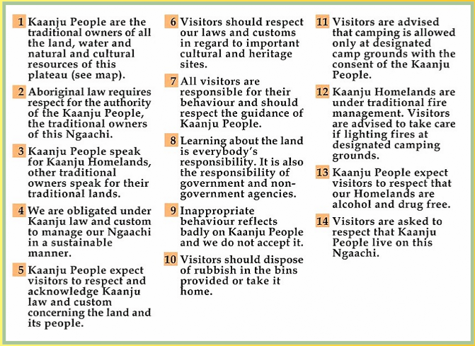
As part of the management of the Kuuku I'yu (northern Kaanju) Ngaachi we have developed protocols for people visiting and passing through our homelands on the Wenlock and Pascoe Rivers, Cape York Peninsula. These protocols will be displayed on signage throughout our homelands, as well as on leaflets for distribution to tourists and other users of our lands. The purposes of our land and cultural resource management protocols are: (1) to educate the public about the interrelationships of the northern Kaanju people with their traditional homelands; (2) to inform the public that there are rules for appropriate behaviour on our homelands; and (3) that northern Kaanju homelands are under primary Kaanju management.
Map of Kaanju Ngaachi
 Home / Kaanju Ngaachi - Kaanju Pama / Map of Kaanju Ngaachi / Homelands Development /
Chuulangun Aboriginal Corporation / Land & Resource Management / Projects /
Protocols / Top
Home / Kaanju Ngaachi-Kaanju Pama / Map / Homelands Development / 
Chuulangun Aboriginal Corporation / Land & Resource Management / Projects / 
Protocols
 Copyright 2003 by Chuulangun Aboriginal Corporation
C/- Post Office COEN Queensland 4871 Australia
Email: chuula@kaanjungaachi.com.au
Credits  / Disclaimer
 Copyright 2003-09 by:
 Chuulangun Aboriginal Corporation
PMB 30 CAIRNS MAIL CENTRE
Queensland 4871 Australia
Email: chuula@kaanjungaachi.com.au or
chuulangunrangers@harboursat.com.au
Credits  / Disclaimer
This page last updated 10-05-09