

Kuuku I'yu Northern Kaanju Ngaachi
HOME | ABOUT US | HOMELANDS DEVELOPMENT | NRM | CULTURAL HERITAGE | PROJECTS | CAMPGROUNDS | MEDIA | LINKS
"The deterioration of the land is felt by Payanamu, and if proper land management is not carried out Payanuma will not allow the land to be sustainable"


HOME | ABOUT US | HOMELANDS DEVELOPMENT | NRM | CULTURAL HERITAGE | PROJECTS | CAMPGROUNDS | MEDIA | LINKS

In the late 1980s a number of Northern Kaanju families began the permanent reoccupation of their homelands centred on the Wenlock and Pascoe Rivers in Cape York Peninsula, Northern Australia. A community was re-established at Chuulangun, one of the Northern Kaanju clan estates on the upper reaches of the Wenlock River. Chuulangun was a main meeting place for a number of Kuuku I'yu Northern Kaanju clans before being forcibly removed from country over the last century under the protection and assimilation eras of government. So it is now appropriate that Chuula act as the hub for the development of homelands communities on other Kuuku I'yu Northern Kaanju estates including Pa'un and Nhanthanji.
The community at Chuulangun are the first of the Northern Kaanju families to move back permanently to country, and considerable planning has been undertaken to ensure the reoccupation and development of our homelands is sustainable and consistent with Northern Kaanju land and resource management principles.
To view a 12 minute video of the Northern Kaanju people's homelands development click here.
Location
Chuulangun Community
The Early Years
Achievements
Planning for Development
Location
Chuulangun is located on sandridge country on the bottom of an extensive freshwater mountain spring-fed lagoon system. Chuula lies centrally, about two to three hours drive depending on the road conditions, from the Cape York communities of Lockhart River (approximately 90 kilometres to the east), Weipa (about 160 kilometres to the north-west) and Coen (approximately 120 kilometres to the south). Chuula lies within the boundary of the former Lockhart River Deed of Grant in Trust (DOGIT) lands, which in 2001 were transferred back to traditional owner groups under the Aboriginal Land Act 1991 (Queensland) as Aboriginal Freehold under the Mangkuma Land Trust.
Chuulangun is occupied permanently throughout the year, however we are cut off by road for up to six months during the wet season (approximately December to May) by the flooded Wenlock, Pascoe and Archer Rivers, a number of creeks, and areas of flat country that become inundated and are at times impassable, even on foot. This means that access to and from Chuula is difficult or impossible during the 'wet', making it logistically hard for people to stay over the wet season for emergency reasons and the provision of basic services, such as medical attention and food supplies. Nevertheless, there are a number of people whose commitment to homelands is so strong that Chuulangun is a permanent residence all year round despite the difficulties.
Chuulangun Community
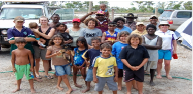
Chuulangun has a permanent dry season population of eleven to twenty people, and a wet season residency of eleven people. This number would be much higher but for the problems of wet season access, and during the dry, limited transport and accommodation. Despite this, on weekends and holidays during the dry season the population is increased, with school children and their families camping, and on several occasions Chuulangun has accommodated up to fifty people.
Due to its central location visitation is high and an estimated 200 individuals each year 'drop in' on their way to and from communities and towns in the region, in particular Coen and Lockhart River where a number of Northern Kaanju people and extended families reside. Some may stay for a short visit, while others camp for a day or two.
The Early Years
The development of Chuulangun as a vibrant, viable homelands community today is testimony to the commitment and hard work of a core of Northern Kaanju people, young and old, who from the early 1970s struggled for recognition as Northern Kaanju Traditional Owners and strove to return to homelands on a permanent basis. Our people had to ask permission to access our own traditional lands and in the early 1990s permission was finally granted from the local Aboriginal Community Council, who was then the land 'owner', to set up a permanent 'outstation'.
In the early years there was very little support from government for 'decentralisation', as government called it, yet our people struggled enthusiastically with minimal resources to rebuild a community on homelands. We used resources immediately available to us, including bush timber and corrugated iron supplied by a neighbouring family on a cattle station to whom we have close social ties. During this early period power was supplied by generator and the only means of communication was UHF radio.
In the late 1980s Chuulangun was occupied for two wet seasons under harsh conditions. On a number of occasions one 'oldfella' had to swim the flooded Wenlock River and walk several kilometres to collect mail and basic supplies from the closest airstrip at Orchid Creek Station. Despite the difficulties experienced during this early period, he and other 'pioneers' of Northern Kaanju homelands development (some of whom have now sadly passed away) recall these early years with great enthusiasm and pride.
Infrastructure
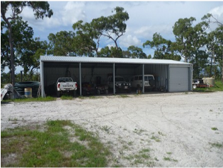
From the mid to late 1990s the following infrastructure was set up at Chuula: three galvanized iron sheds on concrete slabs with bush timber and iron extensions for housing; two kitchens with gas cookers; two septic toilets; four showers and a laundry. Water for drinking, kitchen and laundry use and bathing is pumped from the nearby lagoon to a 5000 litre feeder tank. During this early period power was supplied by diesel and petrol run generators.
Some of this infrastructure was acquired via funding from the former Queensland Department of Community Services (now Department of Aboriginal and Torres Strait Islander Policy, DATSIP) and piecemeal funding through the (former) Aboriginal and Torres Strait Islander Commission (ATSIC).
In recent years the Chuulangun Aboriginal Corporation has secured funding under the Department of Families, Housing, Community Services and Indigenous Affairs (Cwealth), for the construction of modular housing to accommodate the Chuulangun Rangers.
Communications
At the instigation of members of the Chuulangun community, in 2000 a permanent telephone for communication and satellite dish were installed for free-to-air television and radio stations. Broadband satellite Internet access was established in September 2002.
These communication facilities and services have been very important to the growth of our community, and to the Chuulangun Aboriginal Corporation which was formed in July 2002. The telephone and Internet access in particular have been integral to our organisation's activities as the majority of transactions have to be done electronically due to our remoteness and a limited postal service.
In 2008 wireless Internet was set up for the ranger office and school room under the then Australian Broadband Guarantee, and this internet was more recently upgraded under the NBN. Our telephone communications has also recently been improved with the installation of Satellite Telecommunications system which will support up to four lines.
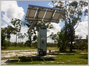
In 2010 a community phone was installed at Chuulangun under the Commonwealth Indigenous Communications Program. In 2013 wifi internet was also set up on the community phone for community use.
Access and Transport Issues
Access to Chuulangun from the main gazetted road is via a gravel track. This road passes through alluvial flat country that becomes inundated during the wet season rains. Access by four-wheel-drive via this road is difficult or impossible when there are heavy soaking rains, and when the main gazetted road is open after the wet season this track is often still hazardous for vehicles. With minimal funding and mainly in-kind contributions Chuulangun Aboriginal Corporation has undertaken work to improve this road for all season access.
In the early years the Chuulangun community relied on private vehicles and those leased with ATSIC 'Wishlist' funding for transport. In the case of the latter in particular, problems arose due to the very high demand placed on vehicles and the often excessive running and maintenance costs involved.
More recently Chuulangun Aboriginal Corporation has accessed vehicles for land and resources management activities via funding from the Queensland land and Sea Indigenous Rangers (Wild River Rangers) and Australian government Working on Country and Indigenous Protected Area programs.
Planning for Development
Since our reoccupation of our homelands in the late 1980s we have been planning for the sustainable development of our community at Chuula and for communities on other Kuuku I'yu Northern Kaanju clan estates. A number of reports have been written by and for the Chuulangun community that examine homelands development planning and funding issues. These include:
Airstrip and Access
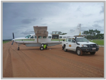
Due to the remoteness of Chuulangun in the early years we struggled with problems of access to essential services, particularly during the wet season. In late 1999 pioneer work was done on the Chuulangun airstrip. An area of 1300 metres x 100 metres was cleared, but much work was needed for the airstrip to meet the requirements of the Royal Flying Doctor Service (RFDS) and Civil Aviation Safety Authority (CASA). This early work was made possible by the planning and initiative of Chuula residents and with funding from ATSIC's Wishlist programme.
From 2002 we sought funds for completion of the work on the Chuulangun airstrip, and finally in late 2005 we received grant funds from the former Commonwealth Department of Transport and Regional Services (DOTARS) Regional Partnerships (RP) Programme and the Queensland Government's Rural and Remote Airport Development Program (RRADP).
After considerable planning, coordination and on-ground effort from the Chuulangun Aboriginal Corporation and the Chuula community, the Chuulangun aerodrome is now constructed to CASA guidelines for aerodromes intended for small aeroplane operations. The project was jointly funded by the Chuulangun Aboriginal Corporation, the Regional Partnerships Program, and the Queensland Government's RRADP. The completed airstrip means reliability of access for the community all year round to emergency medical attention through the RFDS, the delivery of mail, fresh food supplies, educational materials, and access to air travel via the Remote Air Service Subsidy (RASS) Scheme.
In 2011 we received funding from the Commonwealth Remote Aerodrome Safety Program (RASP) to re-sheet the runway, improve drainage and install solar runway lighting. This work was completed in early 2012.
Solar Power
In December 2004 a Bushlight Household Renewable Energy System was set up for one household at Chuulangun. The system was established under the Bushlight Program and funded through the former ATSIC. Prior to the establishment of the Bushlight System the community at Chuula relied completely on diesel and petrol run generators that were costly due to the fuel consumption and maintenance required.
Five years after the installation of the household system, Bushlight undertook planning with the Chuulangun community to upgrade to a community system to accommodate additional houses, ranger workshed and the ranger office. The new community system was installed in September 2010.
Homelands Development Information Links
For information about services and programs relevant to homelands development visit our links page.
The community at Chuulangun are the first of the Northern Kaanju families to move back permanently to country, and considerable planning has been undertaken to ensure the reoccupation and development of our homelands is sustainable and consistent with Northern Kaanju land and resource management principles.
To view a 12 minute video of the Northern Kaanju people's homelands development click here.
Location
Chuulangun Community
The Early Years
Achievements
Planning for Development
Location
Chuulangun is located on sandridge country on the bottom of an extensive freshwater mountain spring-fed lagoon system. Chuula lies centrally, about two to three hours drive depending on the road conditions, from the Cape York communities of Lockhart River (approximately 90 kilometres to the east), Weipa (about 160 kilometres to the north-west) and Coen (approximately 120 kilometres to the south). Chuula lies within the boundary of the former Lockhart River Deed of Grant in Trust (DOGIT) lands, which in 2001 were transferred back to traditional owner groups under the Aboriginal Land Act 1991 (Queensland) as Aboriginal Freehold under the Mangkuma Land Trust.
Chuulangun is occupied permanently throughout the year, however we are cut off by road for up to six months during the wet season (approximately December to May) by the flooded Wenlock, Pascoe and Archer Rivers, a number of creeks, and areas of flat country that become inundated and are at times impassable, even on foot. This means that access to and from Chuula is difficult or impossible during the 'wet', making it logistically hard for people to stay over the wet season for emergency reasons and the provision of basic services, such as medical attention and food supplies. Nevertheless, there are a number of people whose commitment to homelands is so strong that Chuulangun is a permanent residence all year round despite the difficulties.
Chuulangun Community
Chuulangun has a permanent dry season population of eleven to twenty people, and a wet season residency of eleven people. This number would be much higher but for the problems of wet season access, and during the dry, limited transport and accommodation. Despite this, on weekends and holidays during the dry season the population is increased, with school children and their families camping, and on several occasions Chuulangun has accommodated up to fifty people.
Due to its central location visitation is high and an estimated 200 individuals each year 'drop in' on their way to and from communities and towns in the region, in particular Coen and Lockhart River where a number of Northern Kaanju people and extended families reside. Some may stay for a short visit, while others camp for a day or two.
The Early Years
The development of Chuulangun as a vibrant, viable homelands community today is testimony to the commitment and hard work of a core of Northern Kaanju people, young and old, who from the early 1970s struggled for recognition as Northern Kaanju Traditional Owners and strove to return to homelands on a permanent basis. Our people had to ask permission to access our own traditional lands and in the early 1990s permission was finally granted from the local Aboriginal Community Council, who was then the land 'owner', to set up a permanent 'outstation'.
In the early years there was very little support from government for 'decentralisation', as government called it, yet our people struggled enthusiastically with minimal resources to rebuild a community on homelands. We used resources immediately available to us, including bush timber and corrugated iron supplied by a neighbouring family on a cattle station to whom we have close social ties. During this early period power was supplied by generator and the only means of communication was UHF radio.
In the late 1980s Chuulangun was occupied for two wet seasons under harsh conditions. On a number of occasions one 'oldfella' had to swim the flooded Wenlock River and walk several kilometres to collect mail and basic supplies from the closest airstrip at Orchid Creek Station. Despite the difficulties experienced during this early period, he and other 'pioneers' of Northern Kaanju homelands development (some of whom have now sadly passed away) recall these early years with great enthusiasm and pride.
Infrastructure
From the mid to late 1990s the following infrastructure was set up at Chuula: three galvanized iron sheds on concrete slabs with bush timber and iron extensions for housing; two kitchens with gas cookers; two septic toilets; four showers and a laundry. Water for drinking, kitchen and laundry use and bathing is pumped from the nearby lagoon to a 5000 litre feeder tank. During this early period power was supplied by diesel and petrol run generators.
Some of this infrastructure was acquired via funding from the former Queensland Department of Community Services (now Department of Aboriginal and Torres Strait Islander Policy, DATSIP) and piecemeal funding through the (former) Aboriginal and Torres Strait Islander Commission (ATSIC).
In recent years the Chuulangun Aboriginal Corporation has secured funding under the Department of Families, Housing, Community Services and Indigenous Affairs (Cwealth), for the construction of modular housing to accommodate the Chuulangun Rangers.
Communications
At the instigation of members of the Chuulangun community, in 2000 a permanent telephone for communication and satellite dish were installed for free-to-air television and radio stations. Broadband satellite Internet access was established in September 2002.
These communication facilities and services have been very important to the growth of our community, and to the Chuulangun Aboriginal Corporation which was formed in July 2002. The telephone and Internet access in particular have been integral to our organisation's activities as the majority of transactions have to be done electronically due to our remoteness and a limited postal service.
In 2008 wireless Internet was set up for the ranger office and school room under the then Australian Broadband Guarantee, and this internet was more recently upgraded under the NBN. Our telephone communications has also recently been improved with the installation of Satellite Telecommunications system which will support up to four lines.
In 2010 a community phone was installed at Chuulangun under the Commonwealth Indigenous Communications Program. In 2013 wifi internet was also set up on the community phone for community use.
Access and Transport Issues
Access to Chuulangun from the main gazetted road is via a gravel track. This road passes through alluvial flat country that becomes inundated during the wet season rains. Access by four-wheel-drive via this road is difficult or impossible when there are heavy soaking rains, and when the main gazetted road is open after the wet season this track is often still hazardous for vehicles. With minimal funding and mainly in-kind contributions Chuulangun Aboriginal Corporation has undertaken work to improve this road for all season access.
In the early years the Chuulangun community relied on private vehicles and those leased with ATSIC 'Wishlist' funding for transport. In the case of the latter in particular, problems arose due to the very high demand placed on vehicles and the often excessive running and maintenance costs involved.
More recently Chuulangun Aboriginal Corporation has accessed vehicles for land and resources management activities via funding from the Queensland land and Sea Indigenous Rangers (Wild River Rangers) and Australian government Working on Country and Indigenous Protected Area programs.
Planning for Development
Since our reoccupation of our homelands in the late 1980s we have been planning for the sustainable development of our community at Chuula and for communities on other Kuuku I'yu Northern Kaanju clan estates. A number of reports have been written by and for the Chuulangun community that examine homelands development planning and funding issues. These include:
- Chuulangun (2011) Kaanju Ngaachi Wenlock and Pascoe Rivers IPA Management Plan. Prepared by the Chuulangun Aboriginal Corporation with the assistance of funding from the Cwealth IPA Program.
- Chuulangun Aboriginal Corporation (2008) Kaanju Ngaachi Wenlock and Pascoe Rivers Investment Strategy.
- Chuulangun Aboriginal Corporation (2005) Kaanju Homelands Wenlock and Pascoe Rivers Indigenous Protected Area Management Plan. Unpublished document, Chuula, Cape York.
- Chuulangun Aboriginal Corporation (2003) Kaanju Homelands Land and Resource Management Framework. Unpublished report, Chuula, Cape York.
- Chuula Community (2002) Chuulangun, Pa'un and Malandaji: Kaanju Homelands Development 2002 and Beyond. Chuula, Cape York.
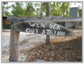
- Claudie, D (1999) Wenlock Outstation Development Plan 1999-2000. Chuula, Cape York.
Airstrip and Access
Due to the remoteness of Chuulangun in the early years we struggled with problems of access to essential services, particularly during the wet season. In late 1999 pioneer work was done on the Chuulangun airstrip. An area of 1300 metres x 100 metres was cleared, but much work was needed for the airstrip to meet the requirements of the Royal Flying Doctor Service (RFDS) and Civil Aviation Safety Authority (CASA). This early work was made possible by the planning and initiative of Chuula residents and with funding from ATSIC's Wishlist programme.
From 2002 we sought funds for completion of the work on the Chuulangun airstrip, and finally in late 2005 we received grant funds from the former Commonwealth Department of Transport and Regional Services (DOTARS) Regional Partnerships (RP) Programme and the Queensland Government's Rural and Remote Airport Development Program (RRADP).
After considerable planning, coordination and on-ground effort from the Chuulangun Aboriginal Corporation and the Chuula community, the Chuulangun aerodrome is now constructed to CASA guidelines for aerodromes intended for small aeroplane operations. The project was jointly funded by the Chuulangun Aboriginal Corporation, the Regional Partnerships Program, and the Queensland Government's RRADP. The completed airstrip means reliability of access for the community all year round to emergency medical attention through the RFDS, the delivery of mail, fresh food supplies, educational materials, and access to air travel via the Remote Air Service Subsidy (RASS) Scheme.
In 2011 we received funding from the Commonwealth Remote Aerodrome Safety Program (RASP) to re-sheet the runway, improve drainage and install solar runway lighting. This work was completed in early 2012.
Solar Power
In December 2004 a Bushlight Household Renewable Energy System was set up for one household at Chuulangun. The system was established under the Bushlight Program and funded through the former ATSIC. Prior to the establishment of the Bushlight System the community at Chuula relied completely on diesel and petrol run generators that were costly due to the fuel consumption and maintenance required.
Five years after the installation of the household system, Bushlight undertook planning with the Chuulangun community to upgrade to a community system to accommodate additional houses, ranger workshed and the ranger office. The new community system was installed in September 2010.
Homelands Development Information Links
For information about services and programs relevant to homelands development visit our links page.


HOME | ABOUT US | HOMELANDS DEVELOPMENT | NRM | CULTURAL HERITAGE | PROJECTS | CAMPGROUNDS | MEDIA | LINKS

Copyright 2003-15 by Chuulangun Aboriginal Corporation | ABN 74277585078 | Contact Us | Credits | Disclaimer | This page last updated 16/06/2015


HOME | ABOUT US | HOMELANDS DEVELOPMENT | NRM | CULTURAL HERITAGE | PROJECTS | CAMPGROUNDS | MEDIA | LINKS
Copyright 2003-13 by Chuulangun Aboriginal Corporation | ABN 74277585078 | Contact Us | Credits | Disclaimer | This page last updated 31/07/2013
Multi-purpose Centre
As the community at Chuula expands there is a strong need for a building that will accommodate offices for the administration of Chuulangun Aboriginal Corporation's activities, as well as the Kaanju homelands land and resource management and enterprise development projects.
It is invisaged that such a building would also provide temporary accommodation for a schoolhouse and healthcare/RFDS clinic room until funding can be secured for a specialised building. A significant number of school-age children make up the permanent residents and regular visitors at Chuula, and would greatly benefit from a school on homelands. Like the airstrip, it is planned that the multi-purpose building will serve not only the growing community at Chuula, but also communities in the region on surrounding homelands, and pastoral and homestead leases.


Housing Programme
The existing housing infrastructure at Chuula is grossly inadequate for our growing community. Completion of extensions on existing buildings, disability and elderly access and facilities and the construction of new housing are priorities for the coming period.
Due to our remoteness the cost of establishing infrastructure such as housing is very high, therefore as part of our community planning we are considering the best options for housing development. The factors we are incorporating into housing design are:
- Cost-effectiveness
- Environmentally appropriate design
- Energy-efficiency
- Functionality


Copyright 2003 by Chuulangun Aboriginal Corporation
C/- Post Office COEN Queensland 4871 Australia
Email: chuula@kaanjungaachi.com.au
Credits / Disclaimer
C/- Post Office COEN Queensland 4871 Australia
Email: chuula@kaanjungaachi.com.au
Credits / Disclaimer
